
East Potrillo Mountains
NOTE: SOME OF THE INFORMATION HERE MAY NOT BE CURRENT. PLEASE GO TO THE RIO GRANDE SOARING ASSOCIATION SITE GUIDE FOR THE MOST CURRENT INFORMATION.
Doña Ana County, New Mexico
Torrey Paso launch 31.864917° -107.006817° 4,944' MSL 800' AGL
LZ 31.86905 -106.99456
USHPA required notification: The RGSA recommends that you do not fly at this site as it is not a chapter managed site. If you do choose to fly at this site, you must take full responsibility for your actions, and recognize that you are fully and solely liable for any damage incurred by yourself, to others, or to others’ property. This site is unimproved with significant safety issues, including potentially challenging wind and thermal conditions. Flying at this site can be risky to the pilot, property owners, and our sport as a whole. This site is unpermitted, uninsured, unmanaged, and unimproved.
It is one of only two east facing sites in the region that is soarable. It is part of the Organ Mountains - Desert Peaks National Monument and was developed and first flown by PG pilots Lee Boone (deceased) and Had Robinson.
Flyable Conditions
This is the high desert and conditions are unpredictable. You never really know what is going on until you arrive at launch. We continue to be amazed at how identical forecasts may make one day epic and another day dangerous. Of course, once up in winds aloft things are more predictable but we have to endure the conditions at launch, whatever they are.
It is at least an hour of driving and 20 minutes of hiking to get to the launch area from Interstate 10 exit 8 so it is a good idea to know the conditions before heading out. Here are the things to check if you want to have a better chance at soaring the E. Potrillo Mountains. The range can be flown in thermic conditions, according to your comfort and skill levels, but most paragliding instructors do not recommend soaring mountain ranges when thermals are strong. If you decide to thermal up, go out in front of the range, away from the ridge lift, to find a good thermal – there will always be plenty during most days.
If you just wish to soar the range, here are some tips. The best time to avoid strong thermals is approximately 1.5 hours before sunset. At about 1 hour before sunset, conditions usually start to calm down and you will not be able to get up into the winds above the range (which do not change as a result of darkness). Sometimes, launch is raging and you will have to wait until dark for a sledder to the LZ.
1. If you have XCSkies, check all (6) models for 6K' MSL 1800 hrs. The more the models agree with each other, the better your chances of having good air. If only three look good, for example, then your chances of good air are 50%. If the models show things dying at 1900 hrs. (summertime) launch early. If you do not have XCSkies, check all of the models on Windy.com but it takes longer and Windy does not have as many models.
2. Check the most recent balloon soundings for the region (EPZ) to be sure that the winds are easterly (70-130) at 6K' MSL and up to at least 10K' MSL or so. The more uniform the wind direction is going up, the calmer the air will be. What the winds are doing at 6K' MSL is the most important because that is the air forecast at launch and up and down the crest. Direction greater than SE means more turbulence at launch and less lift. Speeds less than 10 mph may make it hard to get up and stay up. If it's over 17 mph, getting blown over the back may happen. If there is a strong subsidence inversion above 8,000' MSL, this will help isolate the lower air mass from high winds aloft or Jet Stream turbulence if present. Using this MesoWest profile, check the Deming Municipal Airport conditions (#KDMN 32.26222 -107.72056) and the Hachita Valley station (lower left of the profile). If both are easterly, it is a good sign. As the winds turn more SE, the air in the Potrillo range gets more turbulent. Even despite a thorough study of the forecasts and current conditions, the range can still be unworkable. If someone will donate the costs, we will put a wind-talker up there. It is badly needed.
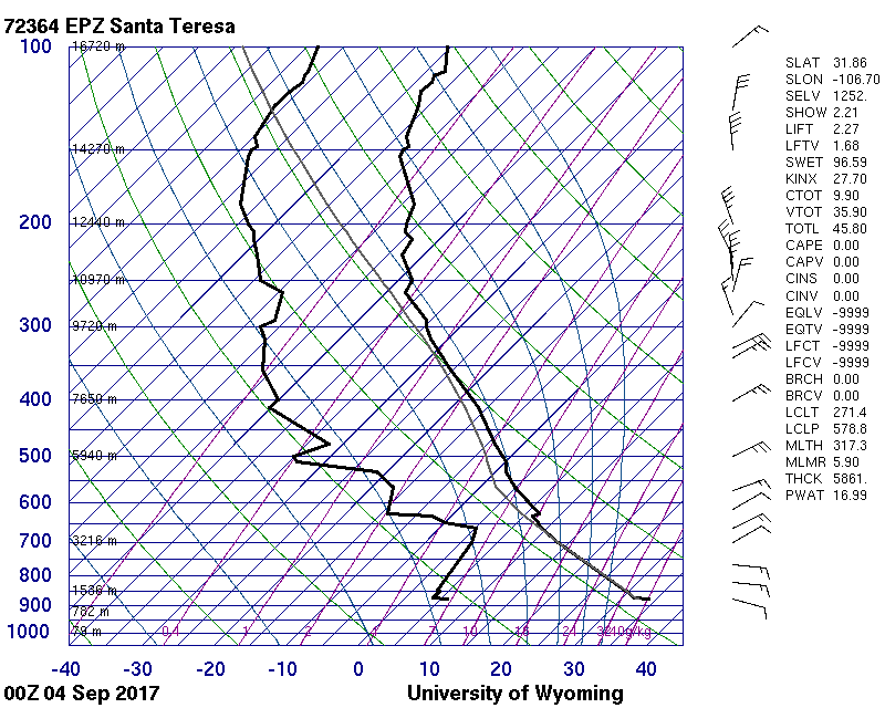
3. This recent skew-t and recent text list (Sept 3, 2017) show why that afternoon was perfect for soaring the range. However, the very next day, with similar soundings and forecasts, the air at launch was crazy – gusting in the 20's, going to zero, all over the place.
If you need help reading a balloon sounding, the weather section of this site has instructions, among other things. Our sport requires pilots to study the weather carefully if they want to fly safely.
Hazards
Lay your glider lines out carefully. Do not launch unless you are certain your glider lines are in order as pilots have inadvertently cut their lines pulling their gliders up.
Do NOT get low near launch as there is significant rotor and turbulence out front due to the fingers going out from the range.
Description
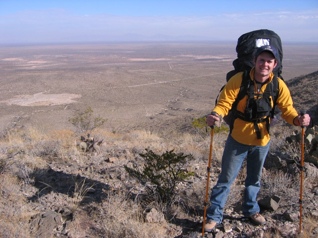
Directions to the Torrey Paso launch. This site is off the grid and has intermittent cell service, depending on your carrier. Access to the Torrey Paso LZ does not require 4 wheel drive but it greatly helps getting closer to launch.
Informally rated H/P3. This range is (7) miles long and is located in south central New Mexico running SSE to NNW. Because of its orientation and slope, it is well suited for ridge soaring with winds from ESE to NE, especially in weak conditions. In laminar conditions, pilots can stay up in light winds if they stay close to the terrain. However, do not fly close to the terrain if there is any chance of turbulence caused by thermals. In the winter, on cloudy days, or late/early in the day the risk of turbulence is negligible. It is never good to fly when a strong Jet is overhead as gusting in the high desert can be severe and sudden if there is any chance of mixing due to the absence of an inversion between where we fly and the Jet. If a trough or some low pressure disturbance is going overhead, that can also cause the Jet to mix to the surface. Pilots have experienced the severe turbulence caused by this mixing.
It is about 20 minutes to hike to Torrey Paso launch. The actual launch area is at the south end of the saddle and in front where there is a small clearing. When conditions are strong, it may be best to launch from the parking area and bench up. Follow the road from the LZ up the east face, park, and then hike the rest of the way. We are working on a lower launch that is safer when winds are strong (so no one will get blown over the back).
In moderate conditions, the full range is flyable. In strong conditions, the lift band is over a 1/2 mile out in front.
In weaker conditions, pilots should turn immediately left (NNW) after launch, stay close to the terrain, and stay in the north end of The Bowl (the lift band which goes about 1/2 mile NNE). If you go further, you may sink out. Thermals from the fingers just north of launch wick their way up to the peak right above. The best thermals in these conditions are about 500' out in front of the peak.
The LZ is huge and unobstructed. However, skilled pilots can land on the road to the parking area to save a 1/4 mile hike. Near the end of the day (an hour before sunset), the katabatic flow out of the mountains (like everywhere else in the southwest) can be significant. Winds aloft and near the surface can be 180 degrees different so be ready to land going downwind. This means landing flares must be very deep and you may have to run it out. Fortunately, the main LZ is fairly flat and, if you have a wind sock planted, you should be able to land into the wind without going uphill.
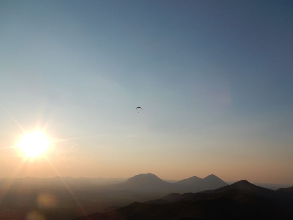
This was one of the days when you drop everything and go flying. Steve Crye follows a cloud street after launching from Torrey Paso and first to do it in this region. He is flying northwest from the E. Potrillo Mountains on his way to Mt. Riley (the mountain in the foreground). Mt. No-name is just behind and Mt. Cox is to the left. Photo by Steve.
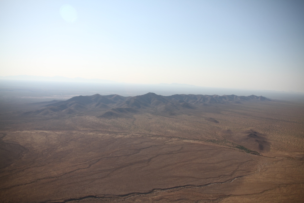
The East Potrillo Mountains – view looking southeast. Photo by Glenn Tupper.
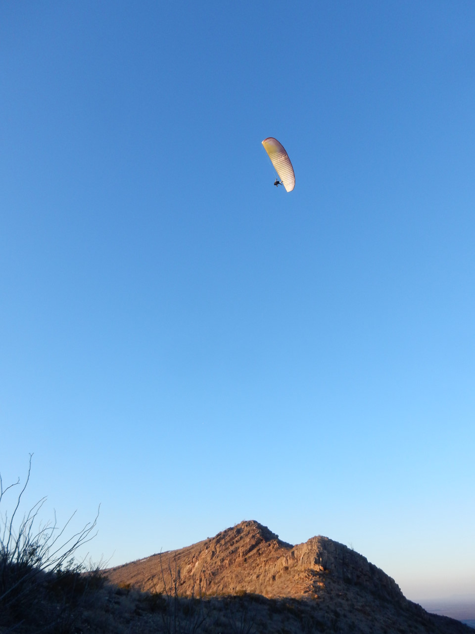
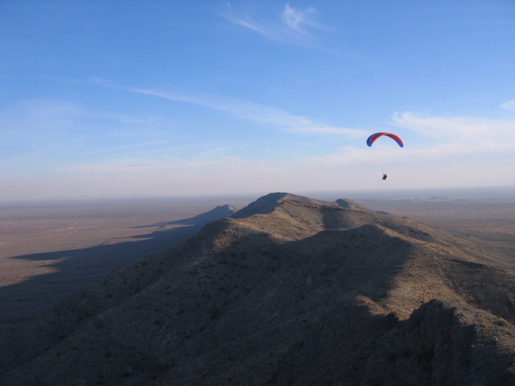
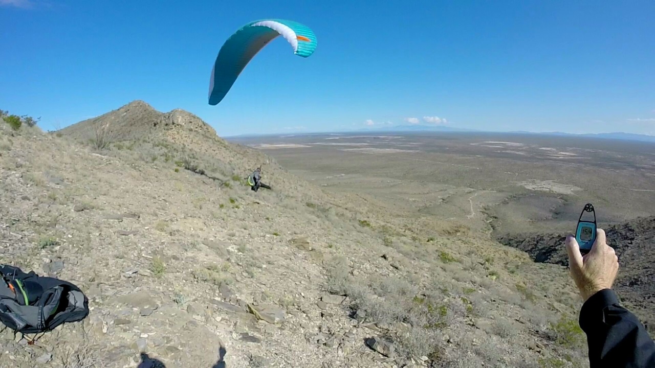
Jason Tilley soaring above Torrey Paso launch.
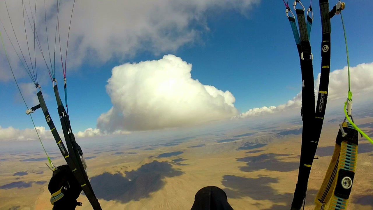
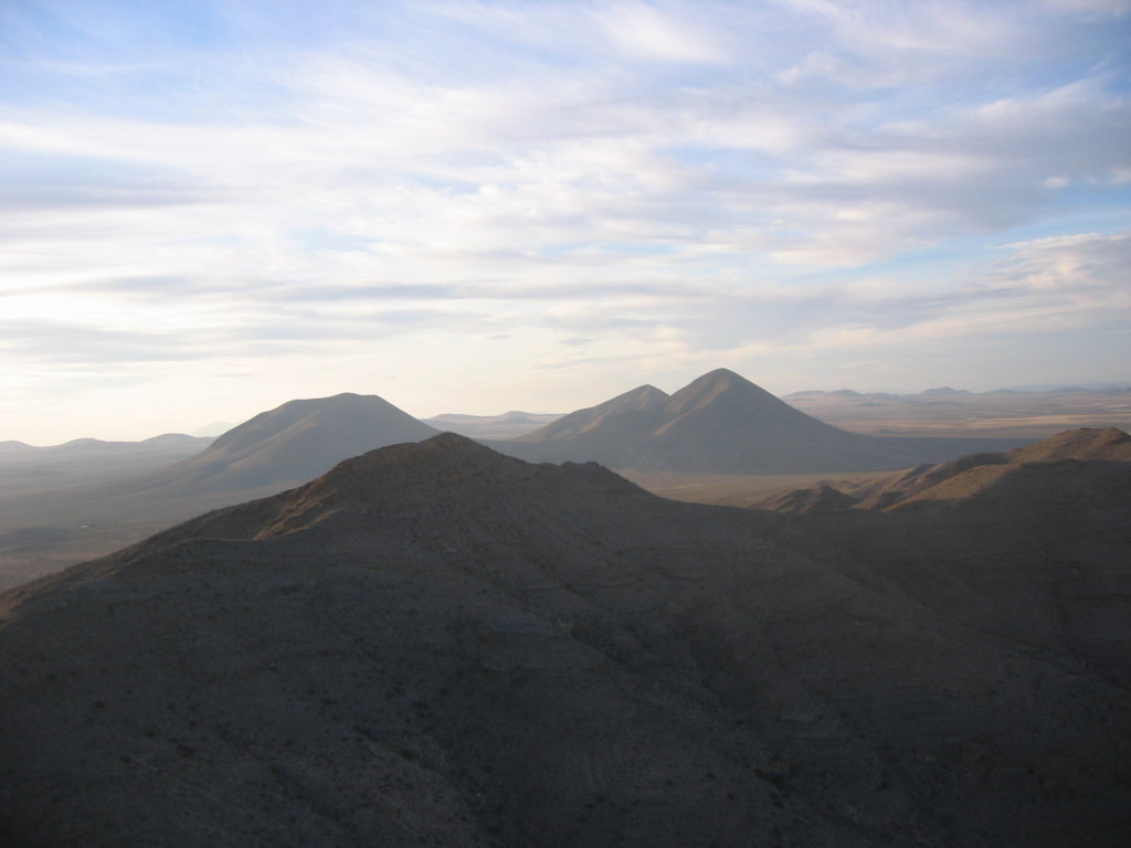
Soaring over the top of the range. View is northwest with Mt. Cox (L) and Mt. Riley (R) in the distance. The pilot in this photo went all the way to the north end of the range.
View south from
launch. Pilot is Lee Boone (deceased)
Looking east from near the Torrey Paso launch. In the far distance (32 miles away) are the Franklin Mountains of El Paso. Lee is getting ready to launch. Here is the HD video of his launch from Torrey Paso.
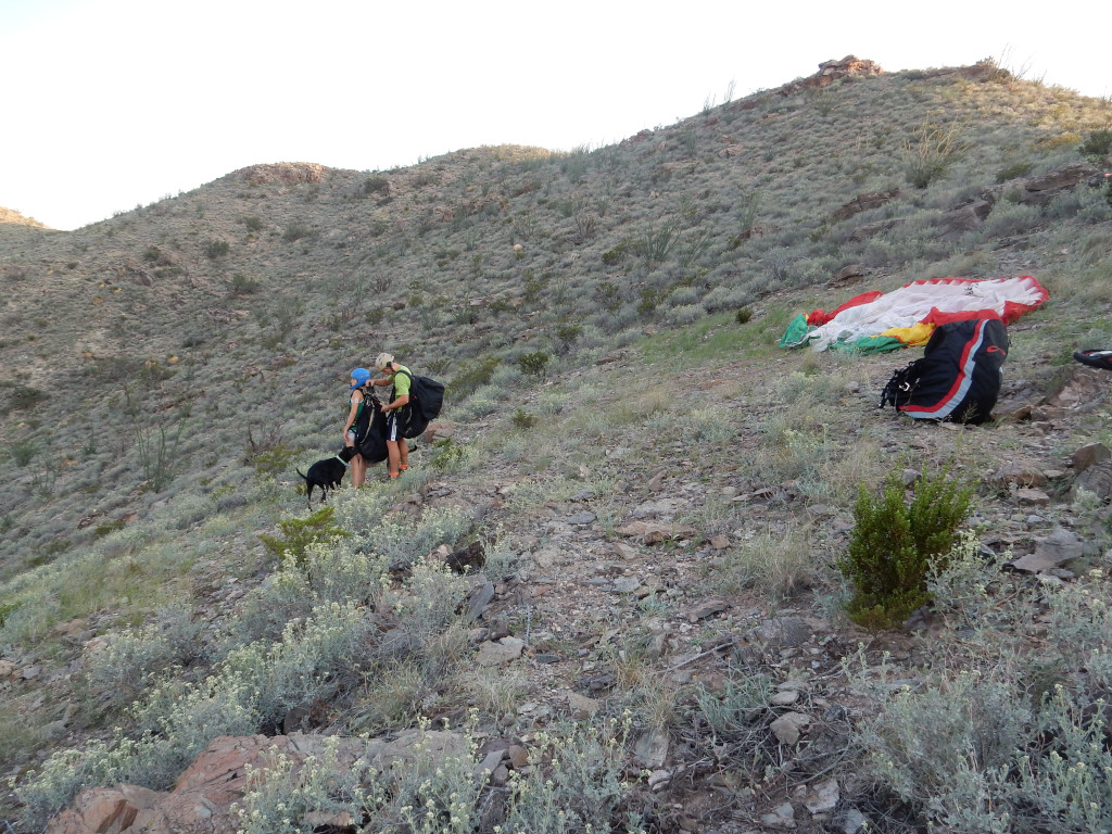
Nick and June Reiter are preparing to do the first tandem ever done in the East Potrillo Mountains. They had an epic flight.
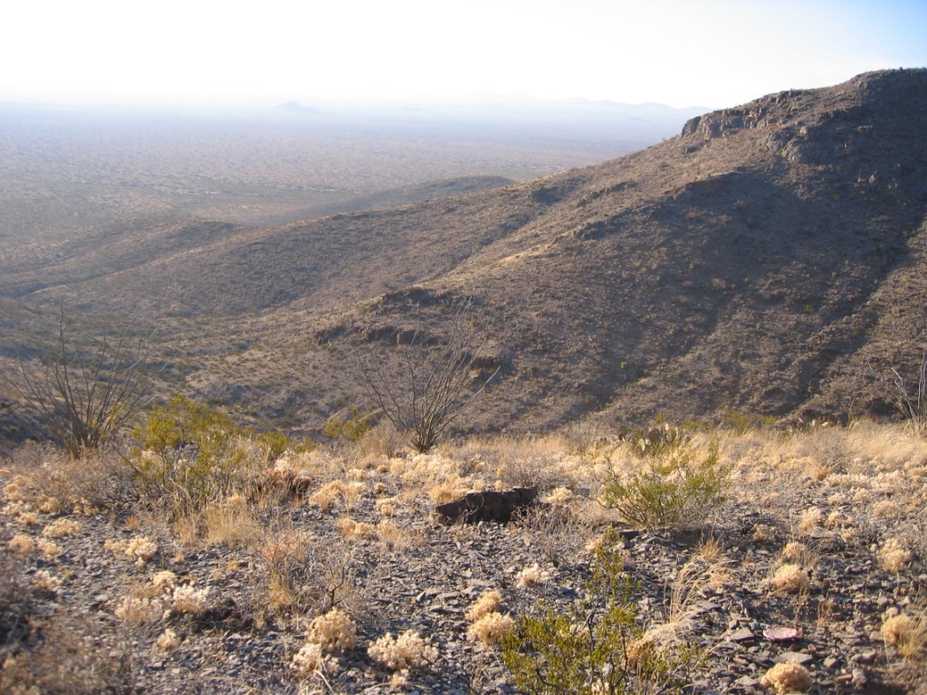
View west near launch. There are countless fingers running out from the crest on the west face of these mountains which would make flying the range with southwest winds difficult because of turbulence. There are no roads running along the west face – you will have miles of hiking if you land on this side of the range.
Max Montgomery launching from Torrey Paso launch. The launch is not sheer in front so pilots can safely abort a run. Steve Crye did a lot of gardening to improve the launch area for us. When thermic conditions were present, Steve and Max proved that pilots can get away to the west and northwest, even getting to the thermal goldmines in the Potrillo Volcanic Field (15) miles northwest of the range. Photo by Steve.
![]()

