
Dry Canyon
NOTE: SOME OF THE INFORMATION HERE MAY NOT BE CURRENT. PLEASE GO TO THE RIO GRANDE SOARING ASSOCIATION SITE GUIDE FOR THE MOST CURRENT INFORMATION.
HG launch 32.927172° -105.885840° Alamogordo, NM 7,013' MSL
2,400' AGL Rated H/P3 or H/P2 with an USHPA instructor
present.
PG launch 32.925986° -105.883702°
LZ 32.928334° -105.945127°
Bail LZ 32.914331° -105.908480°
Introduction
A premier world class site for PG and HG that has outstanding views of the Tularosa Basin, White Sands National Monument, the City of Alamogordo, and the Sacramento Mountains. The site was discovered and developed by the local hang gliding community many decades ago. We are very thankful for their pioneering work. Its southwest face and the bowl shape of the Canyon make for safe launching and ideal thermal and ridge soaring conditions. It is rare when pilots have a sled ride from Dry Canyon. Glass-offs and cross-country trips are regular features offered to pilots who fly Dry Canyon.
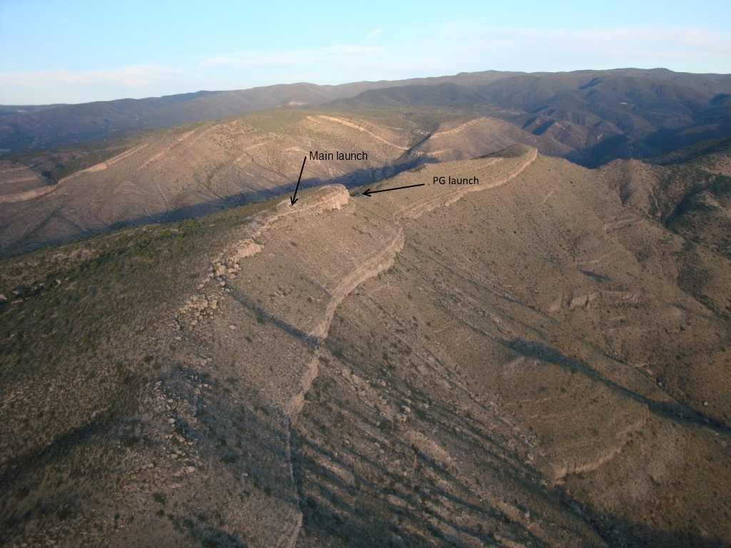
The main launch faces southwest over the Tularosa Basin and is at the center of a huge bowl formed by the Sacramento Mountains. View here is to the east with the 10,000' MSL summit of the Sacramento ridge in the far background.
Steve Crye soaring the ridge in front of launch. Photo by Steve
LZ location
32.928334° -105.945127° All are welcome to visit our landing area in the City of Alamogordo at any time. To get to the LZ: Turn east off of HWY 70 (also HWY 54 and White Sands Blvd.) on Fairgrounds road, go straight past the Griggs Field ball park to the landing zone on the left.
Directions
Restrictions
All pilots must contact the RGSA in order to fly this site and use the landing zone. Only RGSA members and their guests may use the LZ per rules set by the City of Alamogordo. First time pilots must be guided as the site has hazards. Use of Mini Wings at RGSA managed and insured sites is permitted.
Winds
This is a thermic site! Winds at the PG launch area are best when 4-12 mph. Above that, there is a danger getting blown over the back. HG, of course, can fly in much higher base winds but should not launch if winds are below 8 mph. Wind direction should be 240º - 270º. When winds start to go more north, there can be very strong rotor near the ridge going out NW of launch. Pilots have been drilled into the ground (side hill landing) by the rotor when winds were light from the north.
Thermals
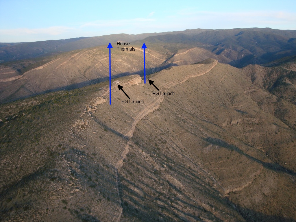
DC has strong thermals that drift through the canyon and often merge near the launch area – making them more powerful. Pilots should be alert to turbulence when thermalling in this area, especially during the summer, and be careful to launch in conditions appropriate to their glider type and skill level. The house thermals are shown in the photo below. Pilots can expect 1,200'/min+ air in the middle of the day during the late spring, summer, and early fall seasons and even stronger rates near launch. The high pressure conditions that are common in the region often make the thermals sharp edged (punchy) with potentially dangerous lee side (downwind) turbulence. Unless you are comfortable and capable of handling glider collapses, we generally recommend that PG pilots stay out of the air from 10:30AM-4:30PM from April until October.
Launch Areas
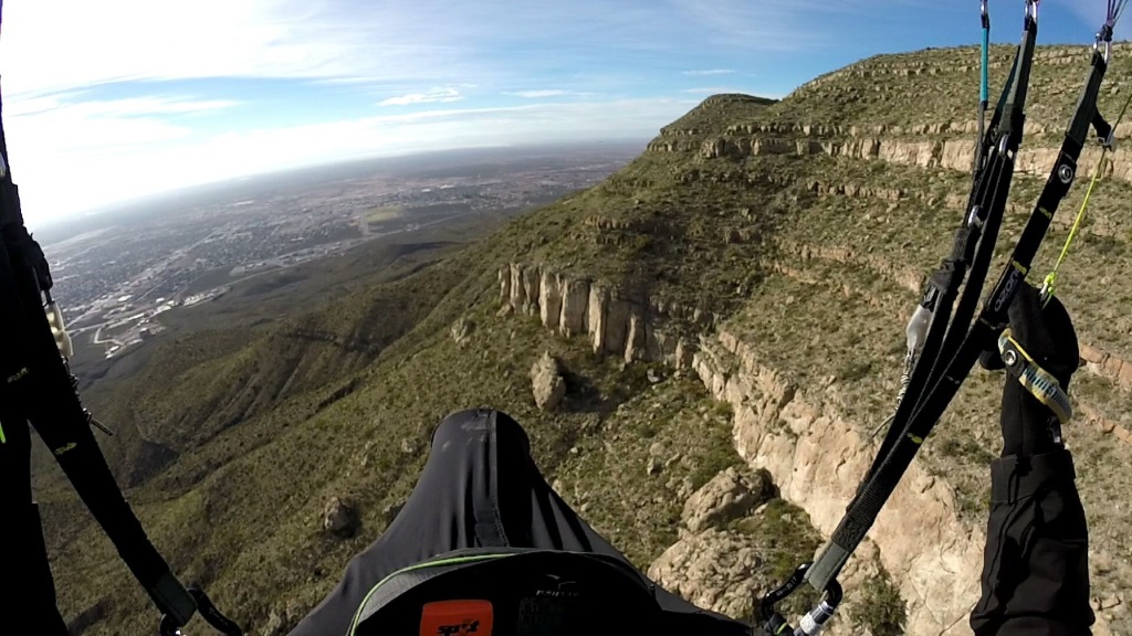
There are separate launch areas for PG and HG. PG pilots should use the safer PG launch area 270 yd. southeast of the HG launch. The HG launch is hazardous for PG for two reasons: 1.) Rotor and turbulence are high because of the nearly shear cliff in front of the HG launch. 2.) There are many sharp rocks in the HG launch area which tend to snag the lines, even cutting them on occasion.
PG Launch into the direction of the wind, turn left (HG launch) or right (PG launch). Be sure to get out in front quickly. Keep a healthy 50 yards between you and the rocks. While the HG launch adds another 70' to launch altitude, it should not matter for PG.
HG Conditions will determine which direction HG pilots will turn when launching. Here is a good launch strategy (courtesy of Robin Hastings): If you go UP off the concrete ramp, turn left. If you go down, or straight out – turn right, and head for the LZ.
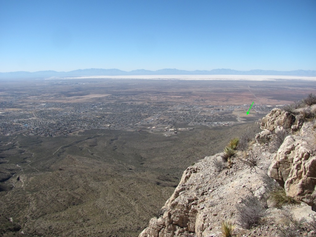
View just northwest from launch. The green arrow points to our 5 acre LZ. Photo courtesy of Christoph Clemens.
For PG pilots Flying during the late fall and winter is the ideal time to fly DC. Thermals are gentle and the ridge soaring conditions are delightful. Pilots can fly the ridge all day and enjoy a glass off above the city of Alamogordo. A dusting of snow can add to the enchantment of flying Dry Canyon.
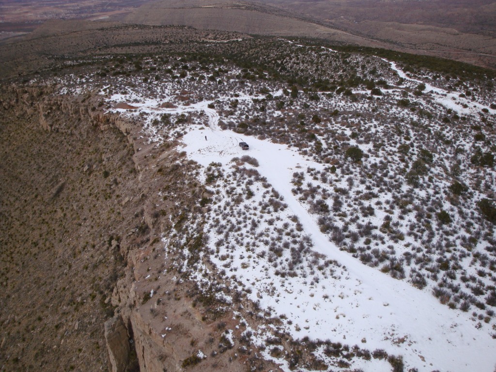
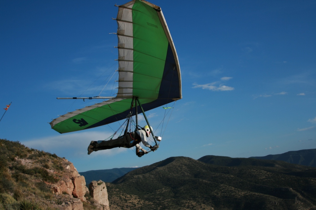
HG launch area on January 27, 2010. Lee Boone (deceased) is getting ready to launch. The LZ in Alamogordo was warm.
General Info & Risks
Top landing (PG only) has now been done a number of times but it is only for experienced pilots. Rotor is less than 10' from the launch surface and does not matter.
Being blown over the back is dangerous so pilots should always be watching their speed over the ground.
Always watch the clouds east of launch and do not launch if you see rain falling west of the Cloudcroft ridge. Watch the weather while flying and be prepared to land immediately if overdevelopment begins. Weather dangers that are from the west can be observed by looking for the white sands kicking up in the air. Thank you, Robin Hastings, for this important tip.
If you look carefully in the photo below, you can see the effects of high winds on the Sands. They will kick up the white sands thousands of feet in the air. Here, the sands have almost blocked the view of the mountains behind them. IF YOU SEE ANYTHING LIKE THIS, DO NOT LAUNCH/COME DOWN IMMEDIATELY as you are about to experience high winds.
Robin Hastings (HG) is an expert on the site and can be contacted by email here if you have questions. Do not fly this site unless you have checked winds aloft as an occasional northwest breeze can swirl around and come straight in at launch but there will be rotor out in front, especially if you get lower than the ridge. Conditions in the Tularosa Basin can be checked by calling the automated weather service at the airport: 575-439-4112.
LZ Info: HG pilots can easily make the LZ in a sled ride from launch. PG pilots, on the other hand, must have altitude greater than the westerly part of the Dry Canyon ridge ("West Ridge") in order to make the LZ. If you are lower, immediately turn southwest and find an LZ in Dry Canyon somewhere south of the Space Museum. Inexperienced pilots should not land on the dirt road just south of the Museum as there are hazards in the area including light poles and fencing. Less experienced pilots can safely use the dirt road that spans the Canyon from northeast to southwest and goes downhill nearly all of the way. It is a hike out but there is over a mile of downhill sloping dirt road that is easy and safe to land on. Do not attempt to land on the dirt road that goes northwest – southeast at the base of the canyon. It is intersected by deep washouts that are hard to see and would be dangerous to land in.
The RGSA hosts other sites in the region. Please the RGSA for more information.
Dry Canyon launch areas & house thermals
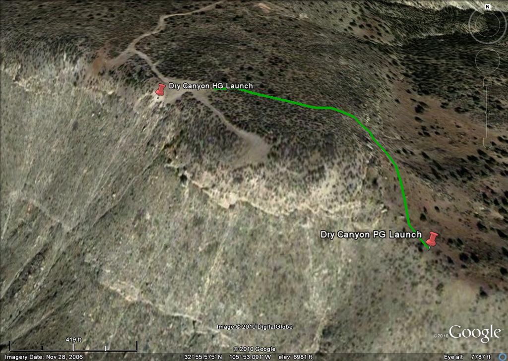
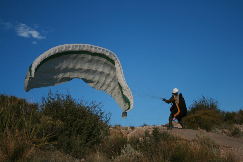
Below is a Google Earth image with path (green) to the PG launch area. It is a short hike (270 yd.) around the back of the ridge and down a small cliff. PG pilots can safely lay out their wing with little rotor or turbulence and without the danger of snagging/cutting their lines. The path is fairly obvious but is not well worn as only pilots use it. (Our thanks to Bo Frazier of the Sandia Soaring Association for his help and suggestions for using the PG launch.)
Robin Hastings just leaving launch. Conditions at this moment were mild as it was getting late in the day and Robin had a safe, easy launch. Photo by David Sanderson.
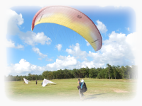
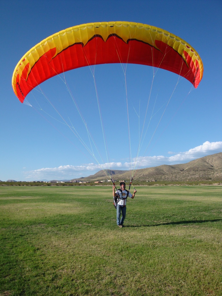
A view of the Dry Canyon LZ. Grady Viramontes is kiting in the LZ. The city of Alamogordo has generously given the soaring community a first class landing zone – a grass covered 5 acre area free of obstructions. We are very thankful for this!
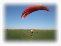
Mike Ellsworth soaring off the face of Dry Canyon. Photo by David Sanderson
A pilot bringing his glider up at the HG launch. As evidenced here, the air coming in past the hang glider ramp is turbulent at the south end which is why we recommend that PG pilots do not use this launch. PG pilots should use the safer launch area 270 yd. southeast of the HG launch. Photo by David Sanderson
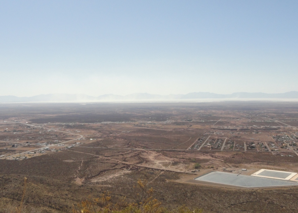
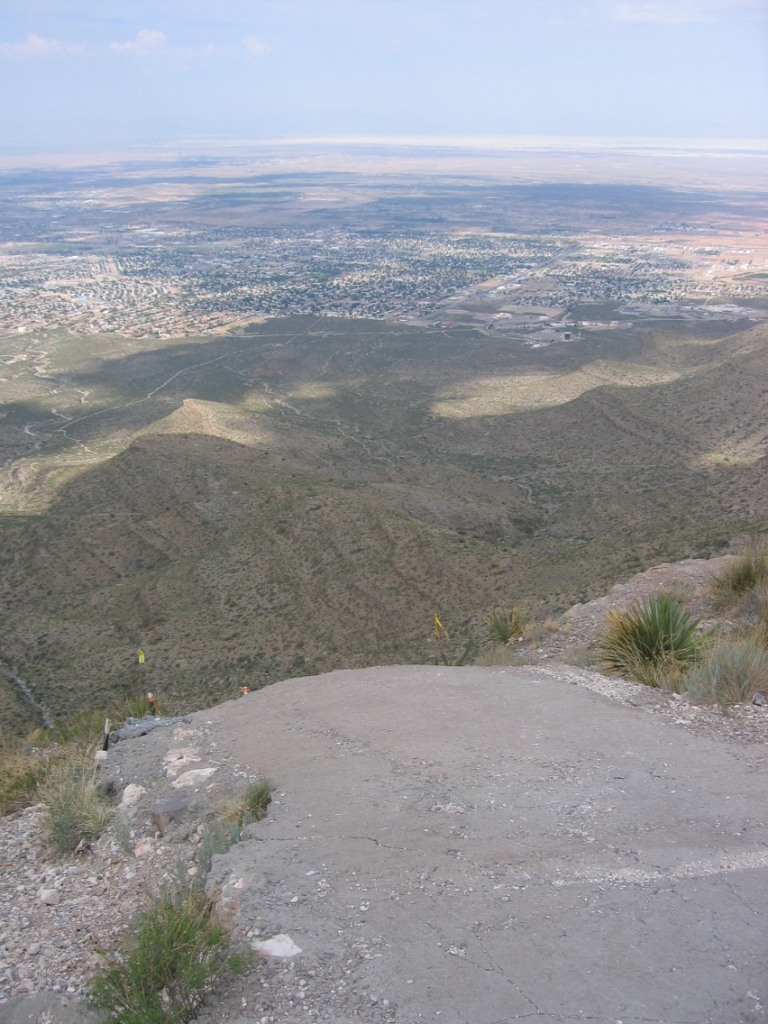
A view from the HG launch ramp (7,000') with the City of Alamogordo, NM and the White Sands in the background.
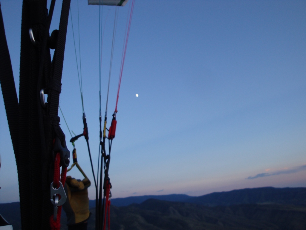
Soaring Dry Canyon late in the day. The white dot in the center is the moon.
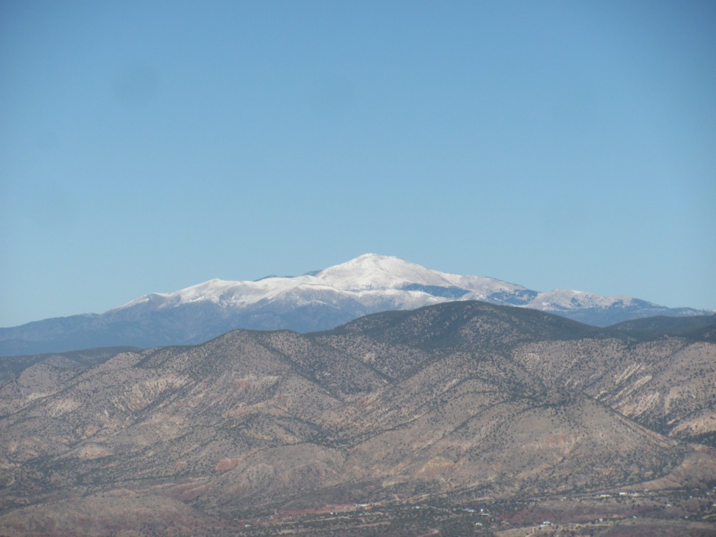
View of snowy Sierra Blanca 12,000' MSL looking north from the HG launch area. Photo taken by PG pilot Christoph Clemens in late November.
Doak Hoover flying above the Dry Canyon launch.
![]()